Mapping, volumetrics and land monitoring
Mines, quarries, forestry and large land holdings: HighCloud delivers orthophotos, DEMs, point clouds and volumetrics with certified drone operations (RPAS) — RTK/PPK acquisition and georeferenced deliverables aligned with your planning cycles.
ROC
Certified operator
RTK / PPK
Acquisition
0
Case studies
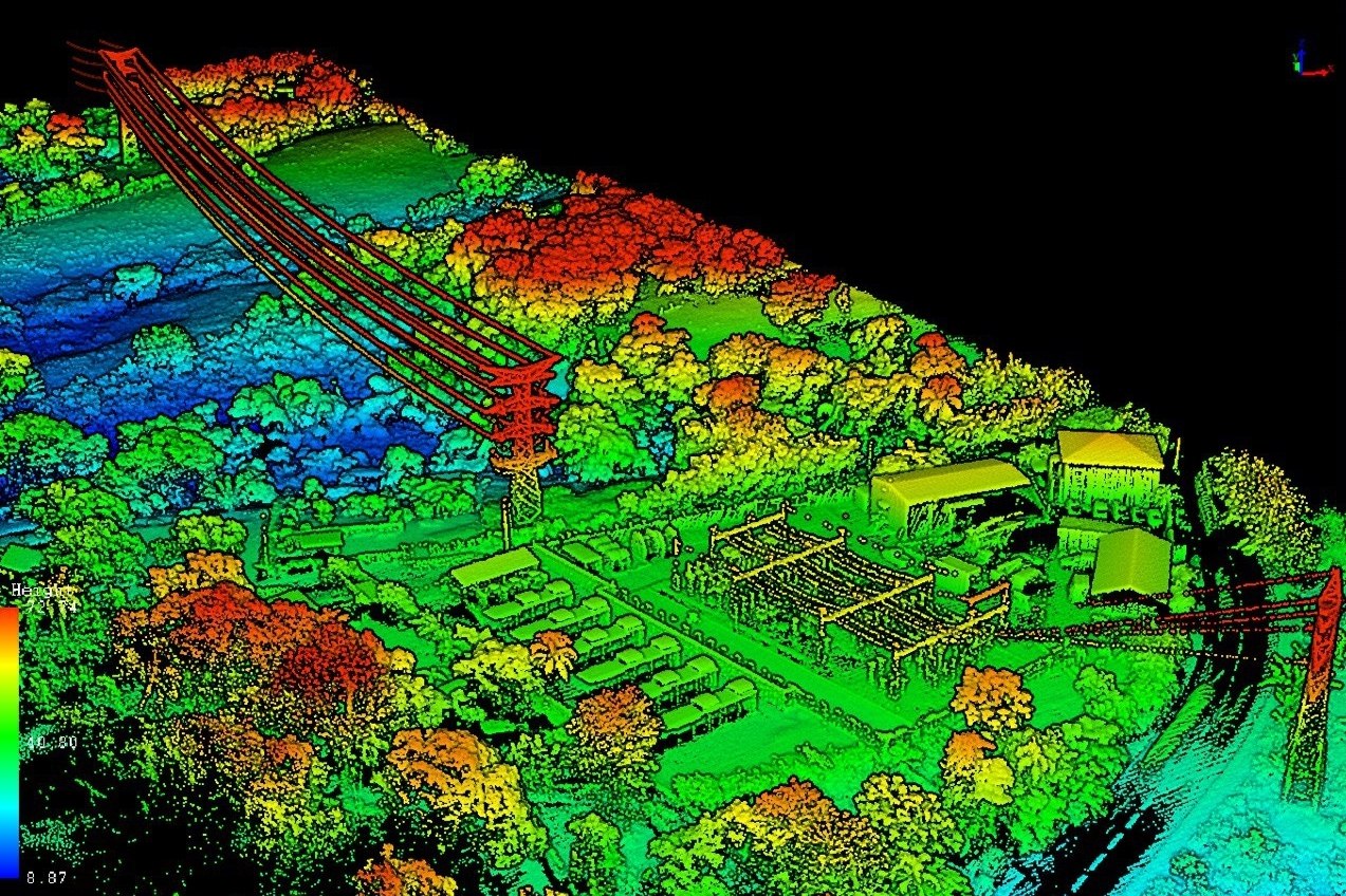
DEM · Ortho · LAS
Typical deliverables
Capabilities for large sites and extractive operations
Mining operators, forest managers, utilities and environmental agencies: we adapt resolution, campaign frequency and delivery formats to your business requirements.
Mining & quarry volumetrics
Stockpile, slope and cut/fill volume calculations by precision photogrammetry — cubage reports, temporal comparison and material accounting support.
Forest inventory & cover
Cover mapping, stand delineation and visual or multispectral inventories for silvicultural planning and land management.
Environmental monitoring
Time series of orthophotos and DEMs for erosion, reclamation, sensitive area monitoring and before/after work documentation.
Precision mapping
Georeferenced orthophotos, digital terrain models, 3D point clouds and GIS exports for engineering, planning and compliance.
Documented geomatics chain
From campaign planning to deliverable handoff: quality control, traceability and formats usable by your technical teams.
Scoping & campaign plan
Perimeter, target resolution, GNSS control, access constraints and operation profile (VLOS, EVLOS or advanced depending on site).
RTK/PPK acquisition
Photogrammetric flight with precision georeferencing, checklists and overlap control for reliable reconstruction.
Processing & quality control
Alignment, point cloud densification, orthomosaic and DEM production — precision metrics validation.
Deliverables & archiving
Volumetric reports, GeoTIFF/LAS/XYZ exports, GIS compatibility and archiving for inter-campaign comparisons.
Technologies & deliverables
RTK/PPK photogrammetry
Centimetre-level georeferencing for volumetrics, DEMs and reliable 3D models on large or hard-to-access sites.
Operating on sensitive and remote terrain
Missions in mining, forestry or northern environments require rigorous airspace planning and environmental compliance. HighCloud holds an RPAS operator certificate (ROC) and applies documented risk management.
- Airspace planning: controlled zones, NOTAM and NAV CANADA coordination when the site requires it.
- Advanced or BVLOS operations depending on site configuration — documentation aligned with Transport Canada (CAR Part IX).
- Compliance with environmental constraints and land access (protected areas, wildlife, local agreements).
- Insurance, MANOPS and traceability suited to recurring campaigns and industrial environments.
References: CAR Part IX, AIM 2025-1 (RPA), RTK/PPK geomatics best practices.
Case studies — mining & resources
Documented missions in volumetrics, mapping and land monitoring.
No published case studies for this sector yet.
Field expertise
Mines & quarries
Stockpile volumetrics, DEMs and recurring orthophotos
Forestry & land
Inventories, mapping and time series
Related resources
Plan a campaign or demonstration
Let's discuss your site: perimeter, target accuracy, campaign frequency and deliverable formats for your teams.